We capture 3D data of your assets with precision and detail
Digitalization with terrestrial 3D laser scanning allows for highly precise and detailed geometric data. Conduct your surveys at lower cost and in less time.
Terrestrial 3D laser scanning is recommended for projects in heritage, topography, or pathology analysis.
OUR CLIENTS SUPPORT US
900k
Digitalized meters
10
Years of experience
40
Qualified professionals
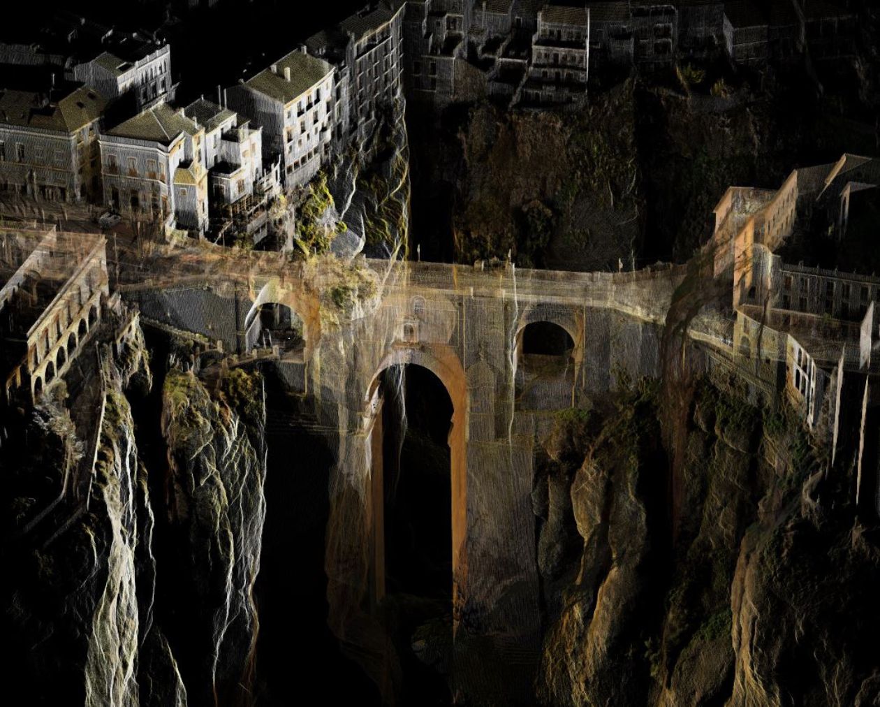
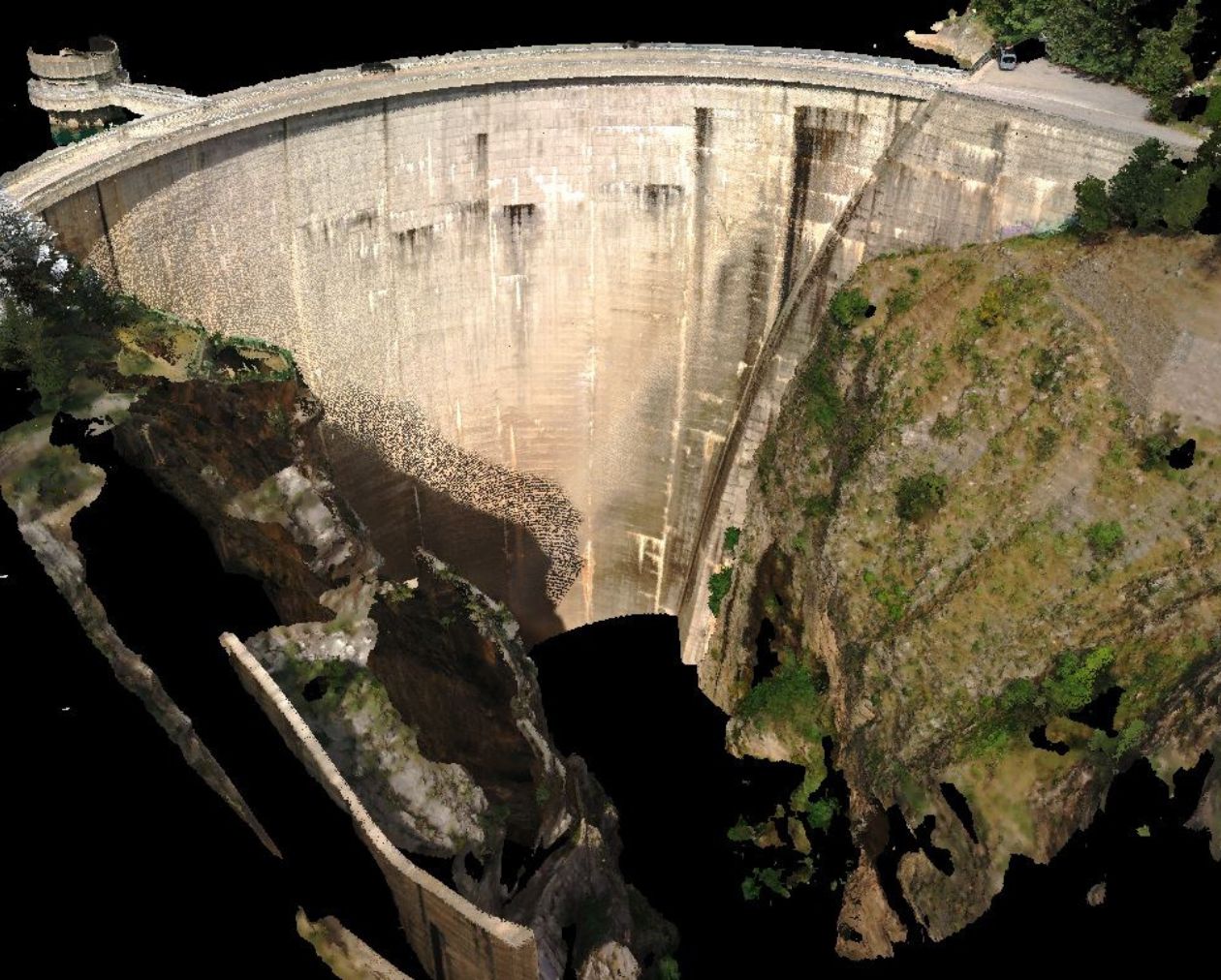
Point cloud with high precision and detail
Terrestrial laser scanner technology allows for obtaining a highly precise point cloud. Ideal for deformation control in heritage, structural analysis for restorations, or dimensional inspection of components.
Long range in open spaces
With a range of 130 meters, the terrestrial 3D laser scanner is the perfect tool for topography projects in open spaces.
The combined use of terrestrial laser scanners and drones allows us to digitize efficiently while ensuring precision is not lost.
Combine point clouds and 360º photography
Thanks to an integrated digital camera, the scanner captures a spherical photograph of the environment to define each point with its true color, giving the resulting point cloud high realism and facilitating model interpretation.
The digital transformation of your organization is possible