Cuéntanos tu proyecto y podremos asesorarte.
With NaVvis VLX Mobile Mapping technology, we capture the building's geometry accurately, comprehensively, and at unprecedented speed.
Mobile scanning is recommended for large-scale projects where a vast amount of information needs to be captured in a short time.
OUR CLIENTS ENDORSE US
900k
Digitalized meters
10
Years of experience
40
Qualified professionals
Benefit from a unique, cloud-based information repository. Centralize all point clouds on a single platform to enhance collaboration. Achieve more efficient and faster workflows.
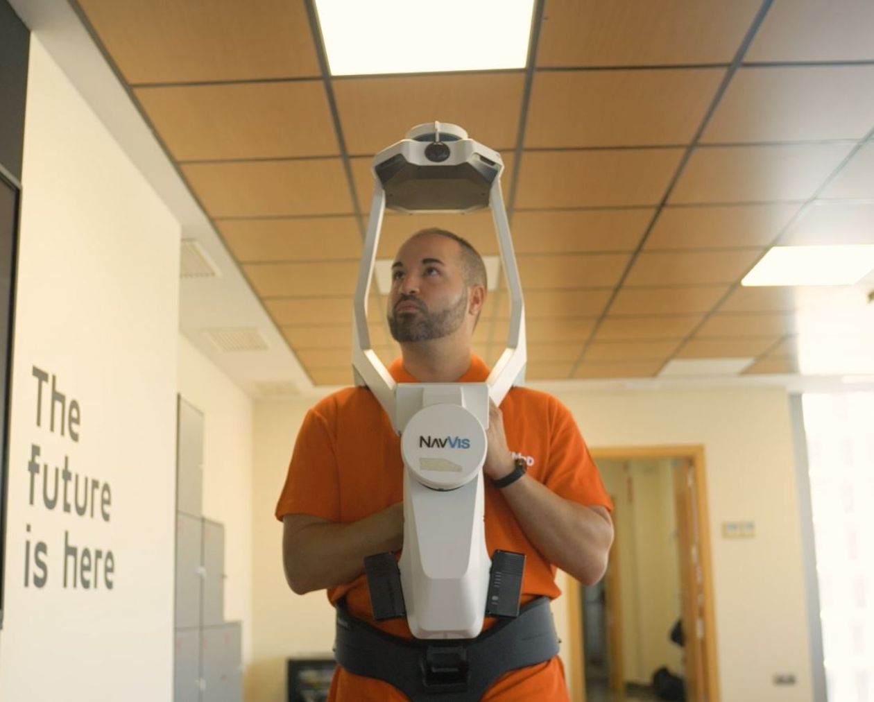
With this technology, we scan up to 10 times faster, allowing us to create a precise and complete point cloud to use as an information base for renovation, expansion, or rehabilitation projects. This enables more efficient collaboration among stakeholders.
Thanks to its integrated camera, Mobile Mapping allows the combination of point cloud data and virtual tours.
The point cloud serves as a basis for developing 2D plans and BIM/3D models true to reality, or for carrying out high-resolution measurements without the need to travel. And 360º photography enables online space visualization, process development, or promotion.
We create a complete point cloud, enabling work with a virtual replica that is always available throughout all phases of the building’s lifecycle. This leads to better-informed decision-making and improved outcomes.
Adding {{itemName}} to cart
Added {{itemName}} to cart