Capture of reality
Your installation converted into accurate data in record time
We digitize with a 3D laser scanner, NavVis VLX mobile mapping and drone.
In 24–48 hours you have the point cloud and the interactive viewer. Without interrupting your activity.
What is reality capture with 3D laser scanning and what it is used for
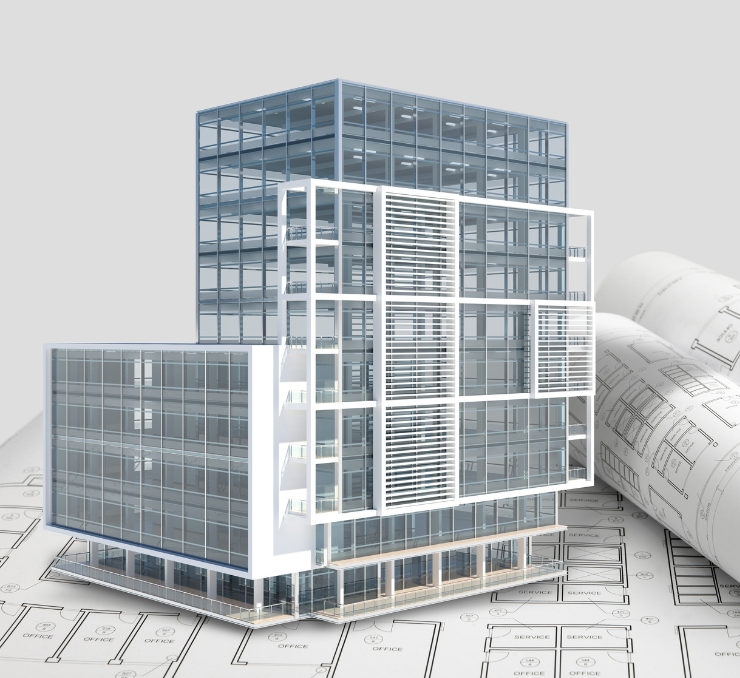
Capturing reality with 3D laser scanning is the process of recording with millimeter precision the real geometry of a space and converting it into a three-dimensional point cloud that can be used as a basis for any subsequent technical project: BIM modeling, renovation engineering, design of facilities, construction monitoring or technical documentation.
3D laser scanning of buildings solves a fundamental problem: most existing documentation of buildings and facilities does not reflect what actually exists. The original plans include what was projected, not what was built. And buildings change over time. A scanner captures the actual state in a matter of hours, without physical contact with the structure and without the building having to be empty.
With NavVis VLX mobile mapping, we scan industrial facilities ten times faster than with a static scanner and without having to stop production.
Do any of these situations sound familiar to you?
You have construction plans but you don't know if they reflect what is there now.
You need to renovate a facility but you do not have updated documentation.
Your engineering team needs precise geometric data before designing something new.
3D laser scanning of buildings and facilities: how it works
El escaneo láser 3D de edificios consiste en capturar con precisión milimétrica la geometría real de un espacio y convertirla en una nube de puntos 3D que puedes usar como base para cualquier proyecto técnico.
A point cloud is the foundation on which any subsequent technical project is built. You can use it to generate the BIM model of your building or plant, to obtain updated 2D plans, to measure any distance or surface remotely, or to create a navigable virtual tour that your team can consult from any device. The process is simple from the outside: a technician walks through the installation with the scanning equipment. The result, however, is much more than a blueprint: it is a faithful digital replica of space, with every centimeter documented, available in the formats your software needs (Revit, AutoCAD, ArchiCAD, Plant 3D).
What changes depending on the technology we use is speed and range. The ground scanner captures as accurately as possible in each static position. The NavVis VLX allows you to scan on the move —ten times faster— without stopping the activity. And the drone reaches where neither of the two previous options can access.
Frequently asked questions
If your question is not here, write to us.
ContactWith NavVis VLX mobile mapping we scan up to ten times faster than with a static scanner. A well-distributed 5,000 m² ship can be captured in one day. More complex installations or installations with areas that are difficult to access may take two or three days.
In 24–48 hours from the end of the scan you have the point cloud processed and the interactive viewer available on the online platform.
With mobile mapping it is not necessary. The equipment scans in motion while the plant or building continues to function normally. It is one of the most important advantages in industrial environments where stopping production has a very high direct cost.
Only in very specific areas with moving equipment that interferes with the capture do we agree on specific time windows. We always plan it before the visit to minimize any impact.
In the formats that your software needs: E57, RCP (Autodesk), LAS and LAZ are the most common. If your team works with specific software that requires another format, you indicate it and we adapt it.
In addition to the point cloud, we provide access to the NavVis Ivion Core platform where you can navigate the space in 360o, make measurements and share access with your team from any device.
Yeah. We are based in Armilla (Granada) but we carry out projects throughout Spain. For large projects outside Andalusia, travel is included in the budget transparently.
For the Irish market we work with local teams. If you have a project in Ireland, tell us and we will tell you how we would manage it.
Do you have a facility you need to capture?
Tell us the approximate dimensions and what you are going to use the data for. We tell you which technology fits.