
Capture of reality
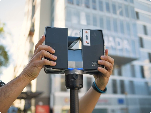
Turn your installation's reality into accurate, actionable insights
We digitize buildings and facilities using 3D laser scanning, mobile mapping, and drone-based data capture.
We generate a point cloud and an interactive viewer that serve as the foundation for project development and digital models, without disrupting the facility’s operations.
What is reality capture with 3D laser scanning and what it is used for
Reality capture using 3D laser scanning provides an accurate representation of the current condition of a building or facility. The captured data serves as the foundation for developing digital models, engineering projects, renovations, refurbishments, and technical documentation.
Working with up-to-date information streamlines design, improves multidisciplinary coordination, and supports the planning of future interventions, providing a reliable foundation for the successful development of any project.
We use technologies such as 3D laser scanning, mobile mapping, and drone-based data capture, adapting the methodology to the specific characteristics and requirements of each building or facility.
Does any of these situations sound familiar?
You're about to start a project, but you're not sure whether the existing drawings accurately reflect the building's or facility's current condition.
You need to renovate or expand a facility, but the available documentation is outdated.
Before designing or carrying out any work, you need an accurate understanding of the asset's actual condition.
3D Laser Scanning for Buildings and Facilities: How It Works
3D laser scanning provides an accurate representation of a building or facility as it exists at the time of capture. The collected data is used to create a digital representation that supports the development of engineering projects, renovations, refurbishments, and other interventions throughout the asset's lifecycle.
The resulting point cloud provides a reliable foundation for developing BIM models, producing up-to-date drawings, performing accurate measurements, or creating a digital representation of a building or facility that supports its entire lifecycle.From the outside, the process is straightforward: a technician walks through the building or facility with a 3D laser scanner. The result, however, is far more than a set of drawings—it is a faithful digital replica of the space, with every detail accurately captured and available in the file formats required by your software.
The technology used is tailored to the specific requirements of each project. We combine 3D laser scanning, mobile mapping, and drone-based data capture to collect the information needed from buildings, industrial facilities, and other assets, ensuring an efficient capture process adapted to the characteristics of each environment.
Frequently asked questions
If your question isn't answered here, contact us.
ContactThe time required depends on factors such as the size of the site, the complexity of the building, the number of areas to be captured, and the level of detail required. Each project is planned individually to ensure a complete reality capture tailored to the client’s specific requirements.
After assessing the characteristics of the asset, we can estimate both the time needed to complete the survey and the scope of the documentation that will be delivered.
In most cases, no. Reality capture using 3D laser scanning can be carried out while the building or facility remains fully operational, with the work carefully planned to minimize any disruption to normal operations.
Yes. Although our headquarters are in Granada, we carry out 3D laser scanning, BIM modeling, and reality capture projects throughout Spain.
We also work on international projects, particularly in Ireland and the Netherlands. If your project is located in another country, we will assess your requirements and provide the solution that best fits your needs.
Do you have a facility you need to capture?
Tell us the approximate dimensions and what you are going to use the data for. We tell you which technology fits.
